


© 2012 Code Blue Designs. All rights reserved.

Learn how to download your map using our special software.


The leader in K9 GPS software.


Our KANINE GPS Downloader will turn your raw K9
Track data into a professional track map.
These are the suggested steps for
downloading your recorded maps.
•
Enter your deployment or training record in the KANINE
Software, if applicable.
•
When finished, shrink the KANINE Software and plug your
GPS Unit into your computer and power it on.
•
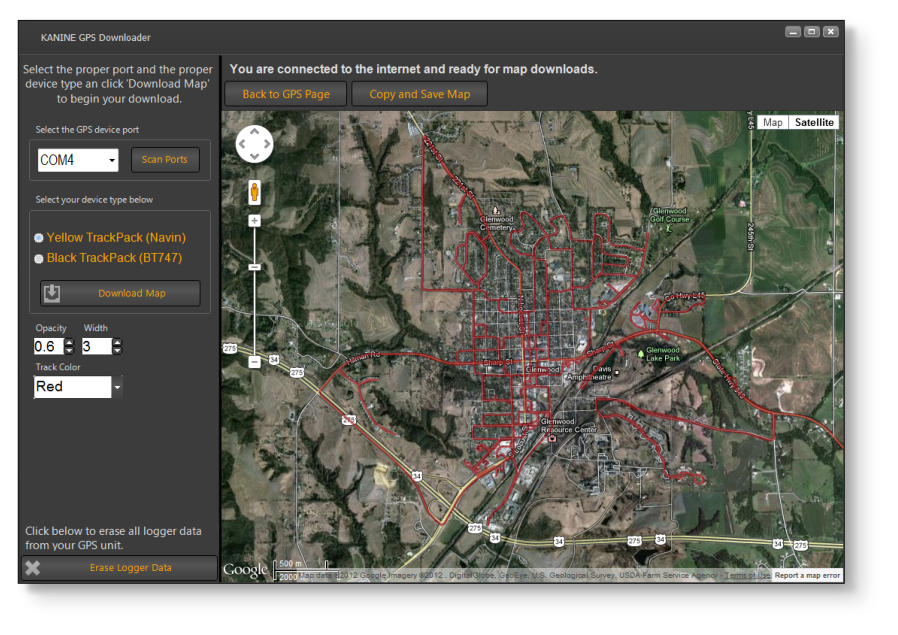
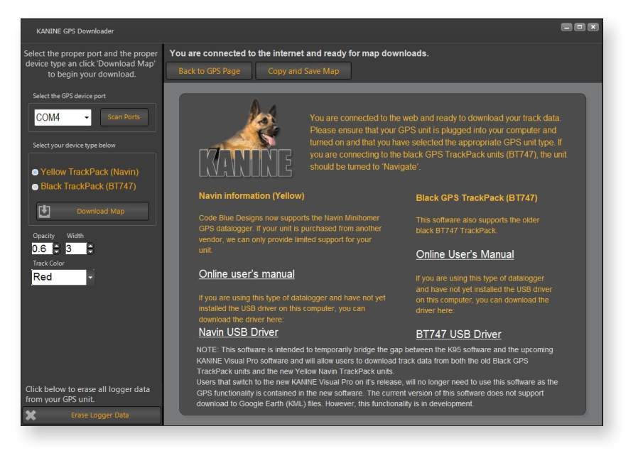
Run the KANINE GPS Downloader application. If the GPS
unit is plugged in and turned on, the software should
automatically locate the correct Com Port to communicate
with the unit. If you run the software before plugging in the
unit, simply click the ‘Scan Ports’ button to have the
software find the correct Com Port for your unit.
•
Select the appropriate GPS unit type that you are
downloading from. The Navin unit is selected by default.
•
Adjust the Track opacity, Track width and Track color from
the provided selection lists.
•
Click the ‘Download Map’ button and wait for your map to
be displayed. NOTE: You must have an Internet
connection for the software to be able to properly display
the map.
•
Zoom in or adjust the map as necessary so that the entire
map fits on the screen.
•
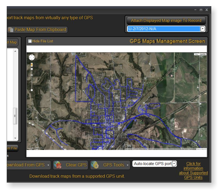
To export the map image to your KANINE Software record
click the ‘Copy and Save Map’ button. You will receive a
‘Save as’ prompt asking where you would like to save the
map HTML file to. By default, this location is set to save to
your KANINE GPS_Files folder, if it is present. Additionally,
this function copies the map image to memory so that
KANINE can import the image of the map and attach it to
the desired record.
•
Now, expand your KANINE software screen and click the
‘Paste Map from Clipboard’ button. An image of your map
will be imported into the KANINE GPS screen.
•
Now, select the record that you want to attach the map to
in the drop down list in the top right corner of the KANINE
software GPS screen and then click the ‘Attach Displayed
Map Image to Record’ button. The map image is now
attached to the selected record. You can also load the
original map, if desired, from the list of maps at the left side
of the KANINE software GPS screen.
NOTE: GPS mapping functionality in the upcoming KANINE Visual Pro will include more functionality and will be
built into the main KANINE Visual Pro system so that installation of the KANINE GPS Downloader software
will no longer be necessary. Additionally, more functionality may be added to the stand alone KANINE GPS
Downloader over the coming weeks. Notifications of these new releases will appear on the main screen of
the KANINE GPS Downloader as they are available. Video tutorials will be coming soon as well.
Click on an image to expand.